

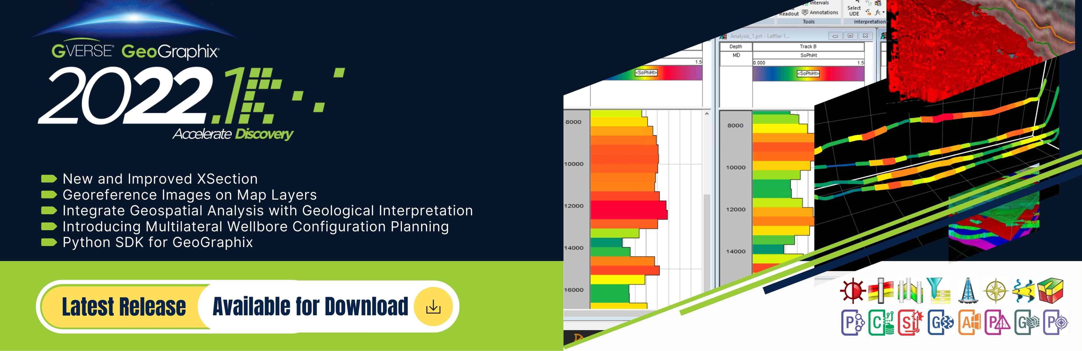
Home > GVERSE GeoGraphix 2022.1
GVERSE GeoGraphix 2022.1 release is the culmination of eighteen months of R&D; effort and includes over thirty new features that help our customers explore for and produce hydrocarbons.
Highlights include more powerful tools for building cross sections, log curve digitization, image georeferencing, Python SDK, a new grid statistics tool and many more features to get you interpreting faster.
Highlights include more powerful tools for building cross sections, log curve digitization, image georeferencing, Python SDK, a new grid statistics tool and many more features to get you interpreting faster.
GVERSE GeoGraphix 2022.1 - Release Highlights
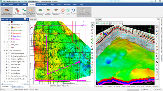
- A completely revamped GVERSE cross section tool that elevates the functionality of XSection. The new tool is fully backward compatible and offers additional features like integrated map & 3D view, integration with GeoAtlas and Geophysics, 3D surface modeling, well-in-zone calculations, better handling of deviated wells, better picking tools, undo/redo, improved usability and much more
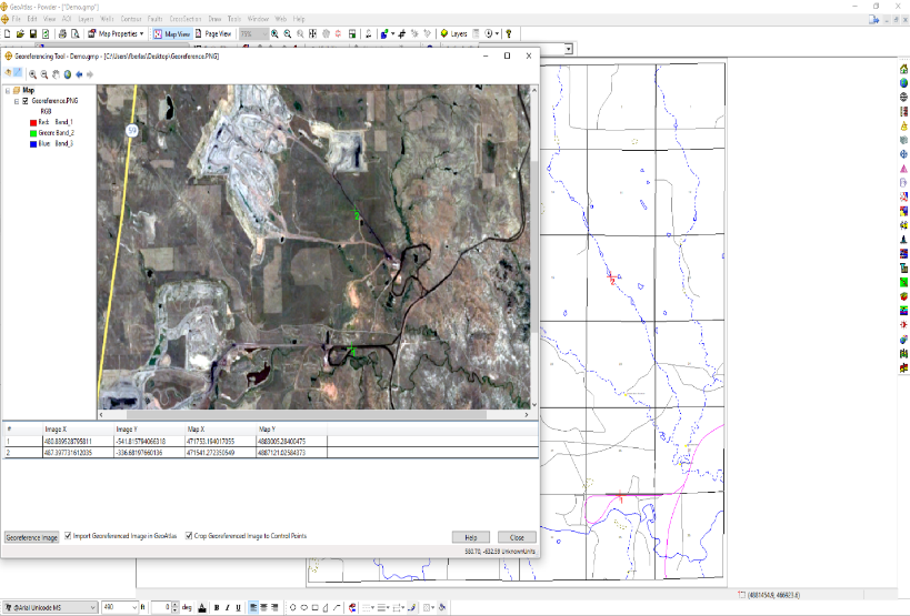
- New image georeferencing and grid statistics tools in GIS and Mapping
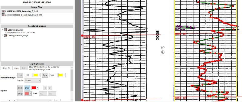
- Digitization of raster logs in DepthRegistration
- Displaying complex log templates in GVERSE Geophysics
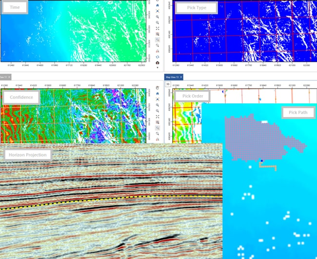
- Auto-picker for 2D lines in GVERSE Geophysics
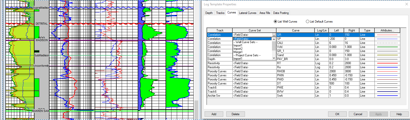
- Curveset independence for log templates in GVERSE Petrophysics
- Improvements in curve data management in GVERSE Petrophysics
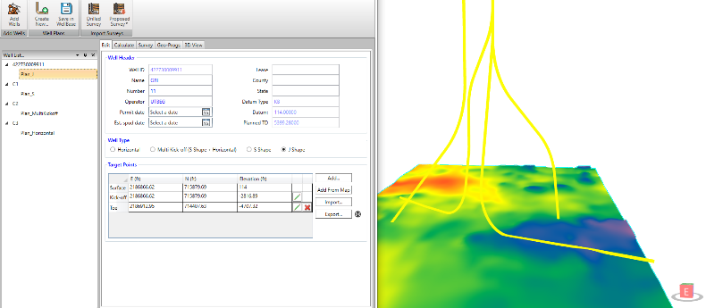
- Ability to plan J-type, S-type and multi-kickoff trajectories in GVERSE Planner
- Leveraging machine learning and artificial intelligence on your data in GeoGraphix projects through Python. Run scripts written in the Python programming language on well, grids, and seismic
- WellXchange and SeisXchange tools’ compatibility with the latest Openworks 10.7 version
- Customer requested bugs & enhancements

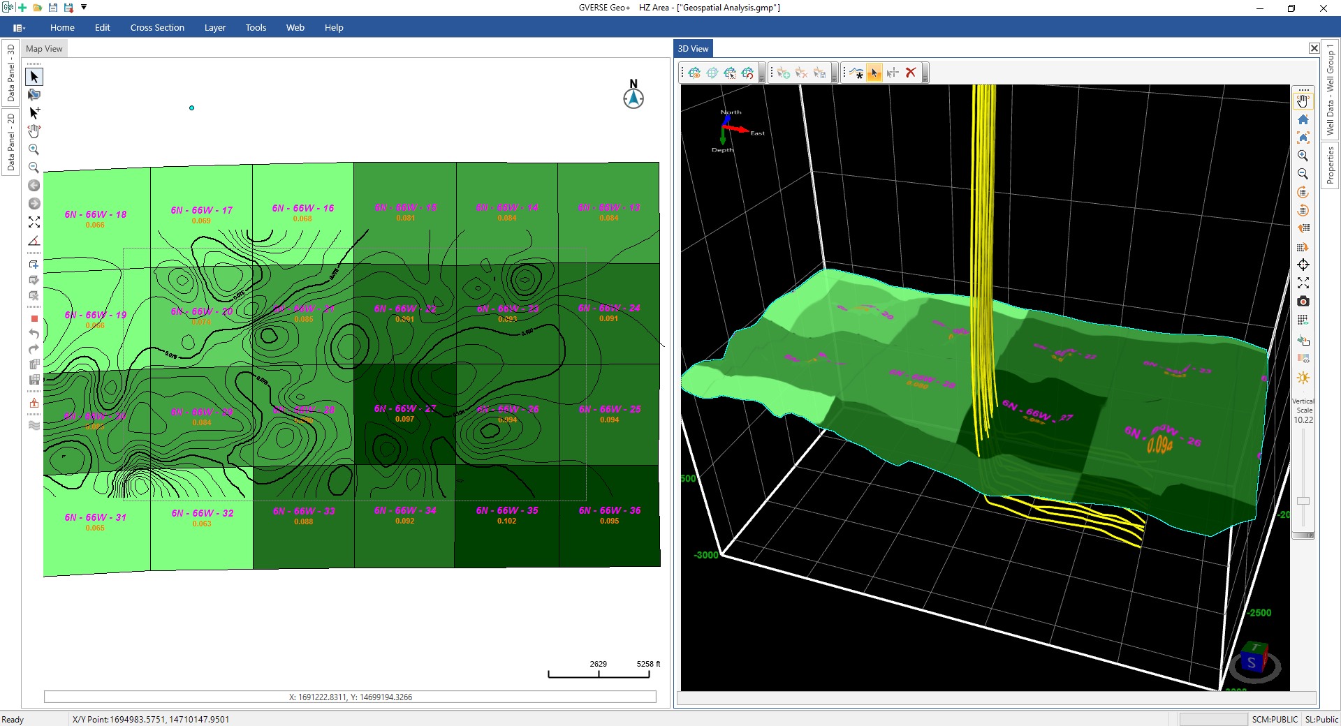
Data Management & Mapping
- Compute grid values from IsoMap layers for Land Survey Polygons, generate reports and create thematic maps based on statistical parameters
- Introducing dynamic data field creation for storing mechanical and geological data associated with depth intervals
- Generate data fields along Wellbore from the IsoMap layers
- Support for Image Georeferencing
- Support for Cross Section creation from multiple WellBase layers
- Honoring the Entity Filter Selections for creating Cross Sections
- Post Key Performance Indicators like Production normalized per 10,000 ft. laterals on the WellBase layers
- Filter wells based on values determined from Key Performance Indicators
- Post first N Months Production on WellBase layers
- Filter wells based on Lateral Length calculated from the user-defined Inclination Angle
- Protect Well Data for multiple Wells and fields by utilizing the List view of WellBase Scout Ticket
- Ability to select the “Name” field for volumetric polygons during Shapefile import in GeoAtlas
- Create a new Strat Column Manager from picks with Sources from the selected Source List
- ZMap+ and ASCII XYZ Bulk Export for IsoMap Layers
- DLS column in the Survey tab of WellBase
- Resizable controls for ZoneManager Edit Zones and Edit Spreadsheet dialog boxes
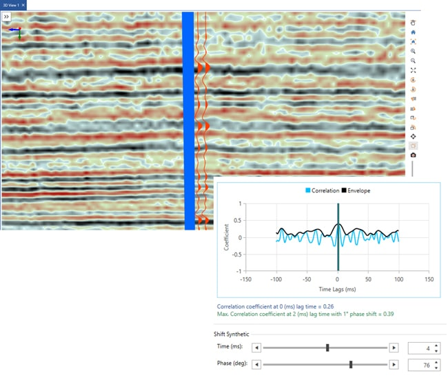
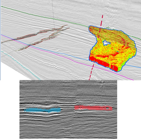
GVERSE Geophysics
- Autopicker for 2D Lines
- Depth mode for time interpretations
- Log templates on seismic
- Custom tracks and scales for SynView
- View velocity model values on seismic sections
- Edit log values directly in SynView
- Despike, upscale and edit log curves in intervals
- Import differently formatted time-depth tables
- One-click display setting match for objects in the 3D scene
- Create clones of interpretation objects
- Snap interpolated picks to events when filling gaps in horizons
- Sync active horizon and fault color between 2D and 3D views
- Horizon, fault, and geobody colors in tree
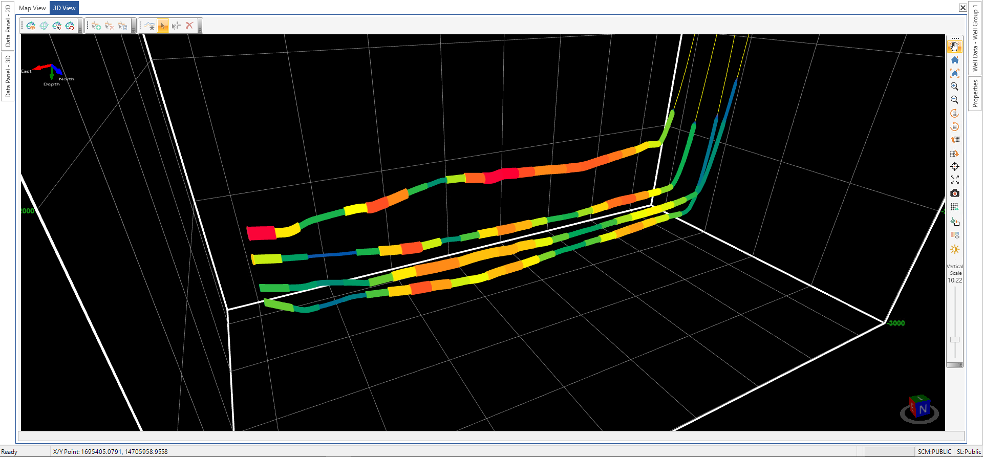
GVERSE Geo+
- Revamped cross section tool
- Templates for well in zone calculations
- Show/Hide all XY points or wells on cross sections
- Display well/surface intersections on map
- Add ZoneManager attributes to well header display
- Allow duplicates in well header and footer display
- Post production values above or below well logs
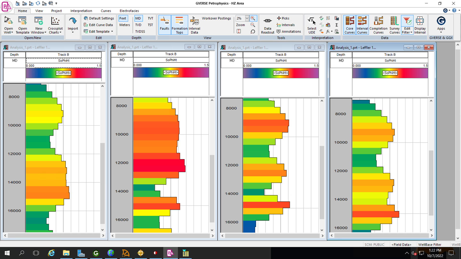
GVERSE Petrophysics
- Curve set independence for log templates
- Log curve digitization
- Comma separated list when importing mnemonics
- Hierarchical field data curve set assignment
- Restrict output of NULL curves for UDE export
- Resizable dialogs
- Change colors for log display and apply transparency to interval selection in cross plot view
- Ignore slashes in well names on import
- Custom labels for DST, perforations and treatments
- Pick or edit formation tops in DepthRegistration
GVERSE Planner
- New well trajectory types
- Ability to add wells from GeoAtlas map to GVERSE Planner
- Import and export of wellbore target points
- Add target points for creating the wellbore trajectory from GeoAtlas map
- Extract drilled and proposed surveys from WellBase
- Generate geoprognosis report from drilled and proposed survey
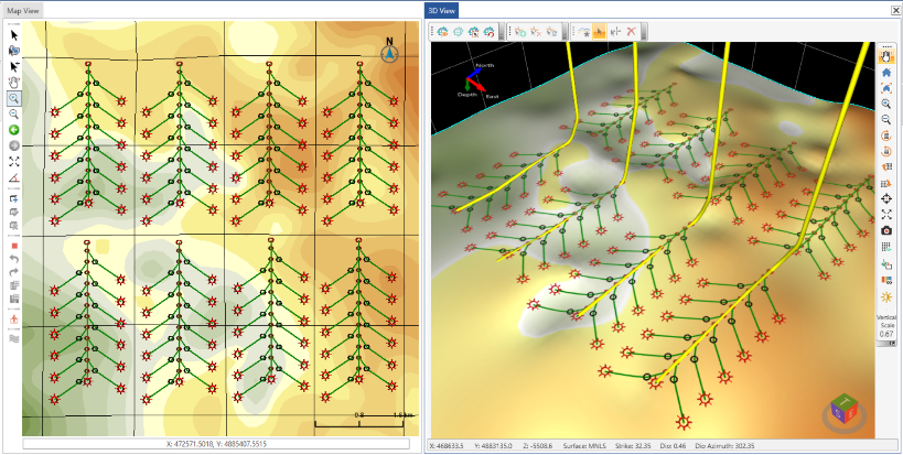
Field Planning
- Introducing fishbone multi-lateral configuration planning
- Automatically generate fishbone multi-lateral configuration from the input parameters
- Manually edit fishbone configuration on the map
- Copy and paste the complete fishbone configuration in desired locations
|
Disclaimer: This web page is a preview and is provided for information only. The information contained herein is subject to change and cannot be guaranteed to be error-free. We therefore do not accept any liability for any errors or omissions in the contents of this web page or for the consequences of any actions taken on the basis of the information provided, unless that information is subsequently confirmed to be accurate in writing. |
GVERSE GeoGraphix 2019.4 SP4
Release Highlights
Release Highlights
