
Geology
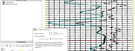
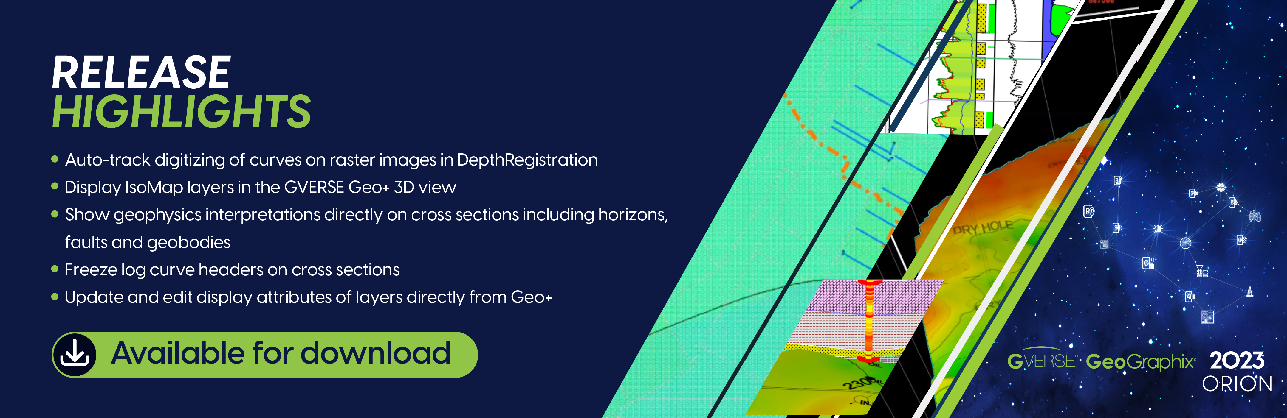
Harness machine learning to automatically trace and save digital curves from raster images.
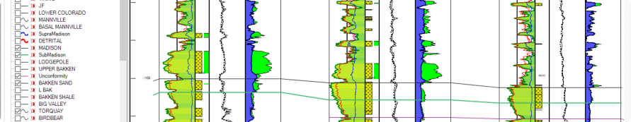
Looks like XSection, Feels like XSection, Is XSection!
Get the enhanced XSection experience. Enjoy the ease and speed of XSection combined with powerful tools that elevate your well correlation workflows, all without the need to redo any of your existing work.
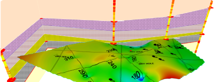
Add a 3rd dimension to your maps. Display IsoMap layers in 3D. Drape IsoMaps, culture data, well spots and all other layer types on surfaces in 3D view.
Minimize toggling between apps. Update data and refine display attributes for layers right on the GVERSE Geo+ map.
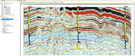
Visualize horizons, faults, and geobodies directly on cross sections. Seamlessly integrate them into geological workflows with on-the-fly depth conversion.
Use IsoMap depth grids to define zones, enhancing your well statistics computations, such as percent in zone.
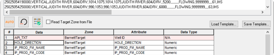
Determine the log template for a well based on specific criteria such as raster-only data, well groups formed via WellBase filters, and more.
with Exceptional Quality
Experience unparalleled clarity with our improved print quality for cross sections
Quickly pinpoint data in map view, cross sections and the 3D view using intuitive search boxes.
Lock curve scales in the cross-section header, and always have them visible as you zoom and scroll your cross section.
Streamline Zone Data I/O
Import ASCII data into ZoneManager with unmatched ease. Use auto-attribute assignment and rigorous data validation to ensure fast, accurate, and user-friendly data import and export.
- Computation of 3 and 4 mineral models using Python.
- APIs for reading/writing UDE-modeled curves..
Data Management and Mapping
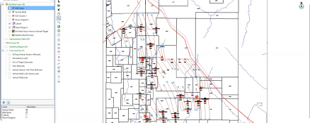
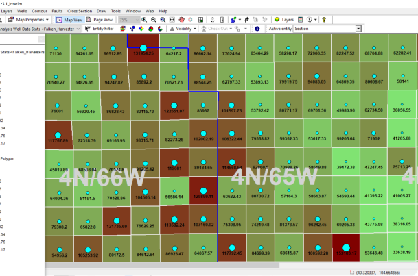
Thematically map well and production statistics over legal polygons with the new Well Data Statistics calculator.
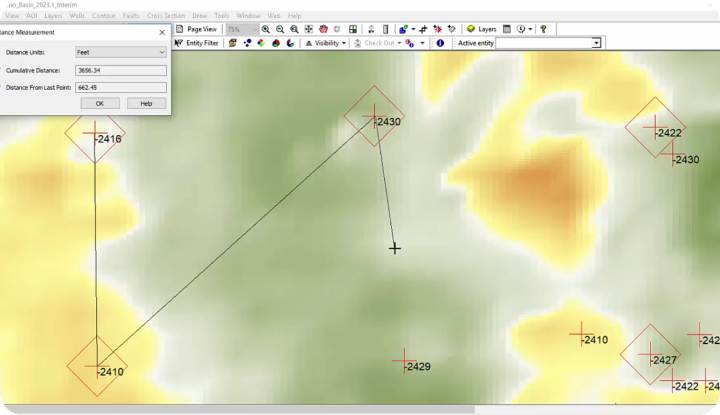
With the new distance measurement tool, measure the distance between objects and features on the map.