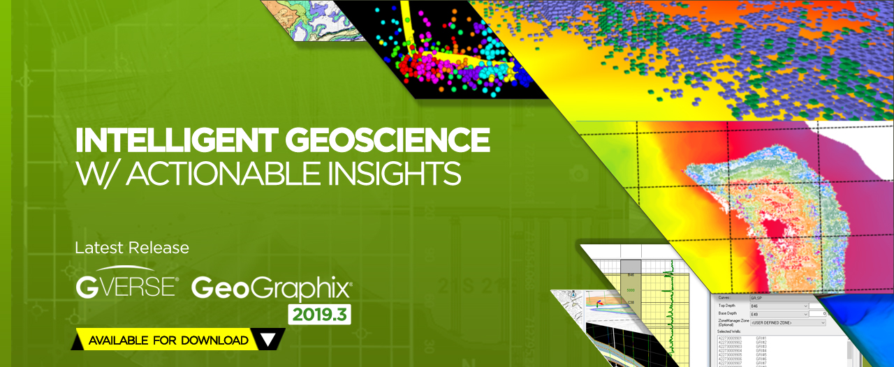
Home > GVERSE GeoGraphix 2019.3
GVERSE GeoGraphix 2019.3 - Release Highlights
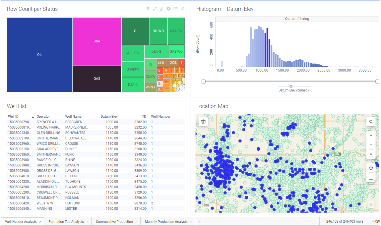
- Spotfire Integration.
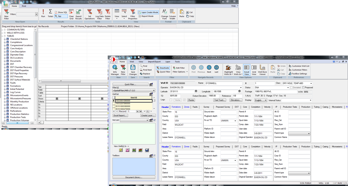
- New Ribbon Interfaces for WellBase and QueryBuilder.
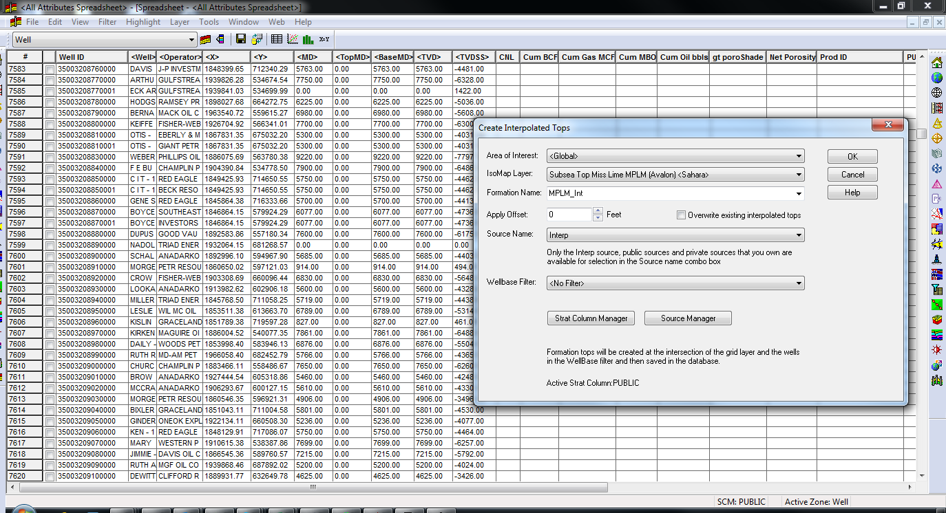
- Calculate interpolated formation tops from Isomap layers.
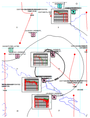
- New XY location tool in GeoAtlas.
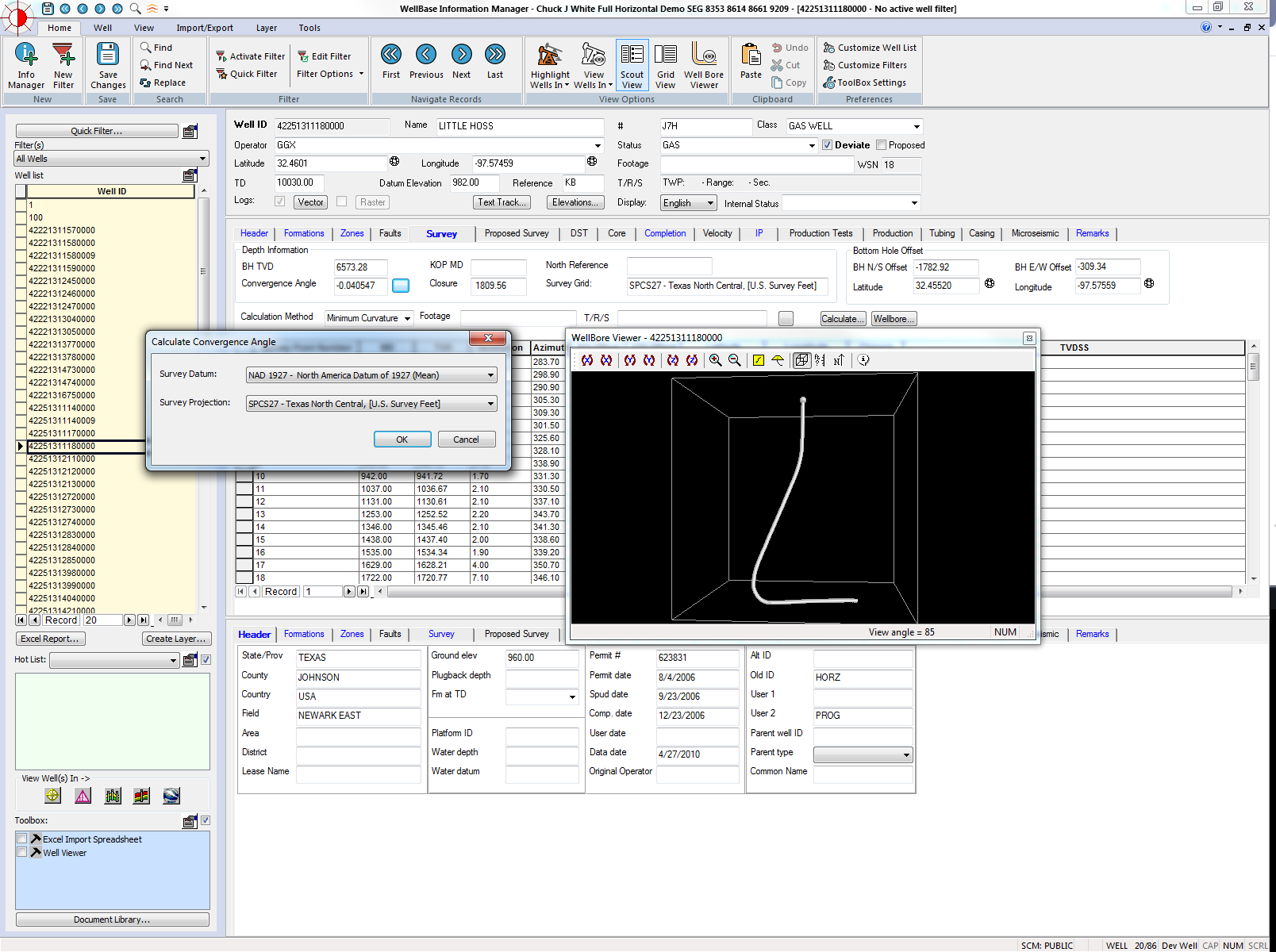
- Automatically calculate grid convergence angles for well surveys using any map projection.
Data Management & Mapping
| 1. Data Analytics through Spotfire Integration. |
|
| 2. Create interpolated tops from IsoMap layers and use to define zones and attributes |
|
| 3. New find XY location tool in GeoAtlas |
| |
| 4. Support for ESRI ArcGIS 10.7 and 10.7.1 |
| |
| 5. Automatically calculate grid convergence angles for well surveys. |
|
| 6. Display conditional pies using zone filters. |
| |
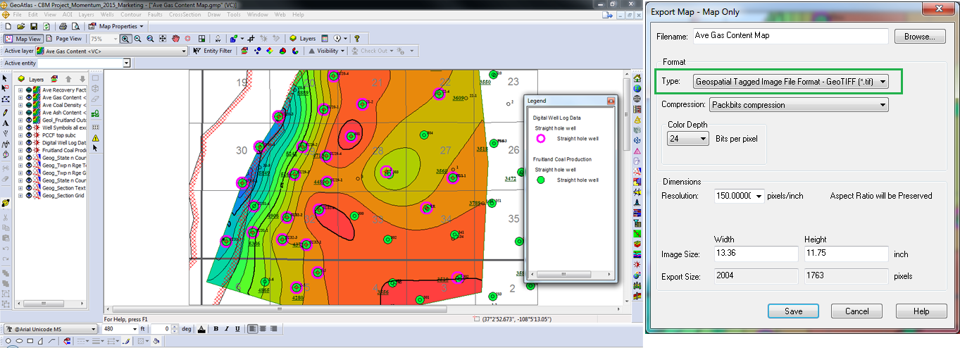
| 7. Export GeoAtlas maps as geotiffs. |
|
| 8. New Microsoft Ribbon interface in WellBase and QueryBuilder. |
|
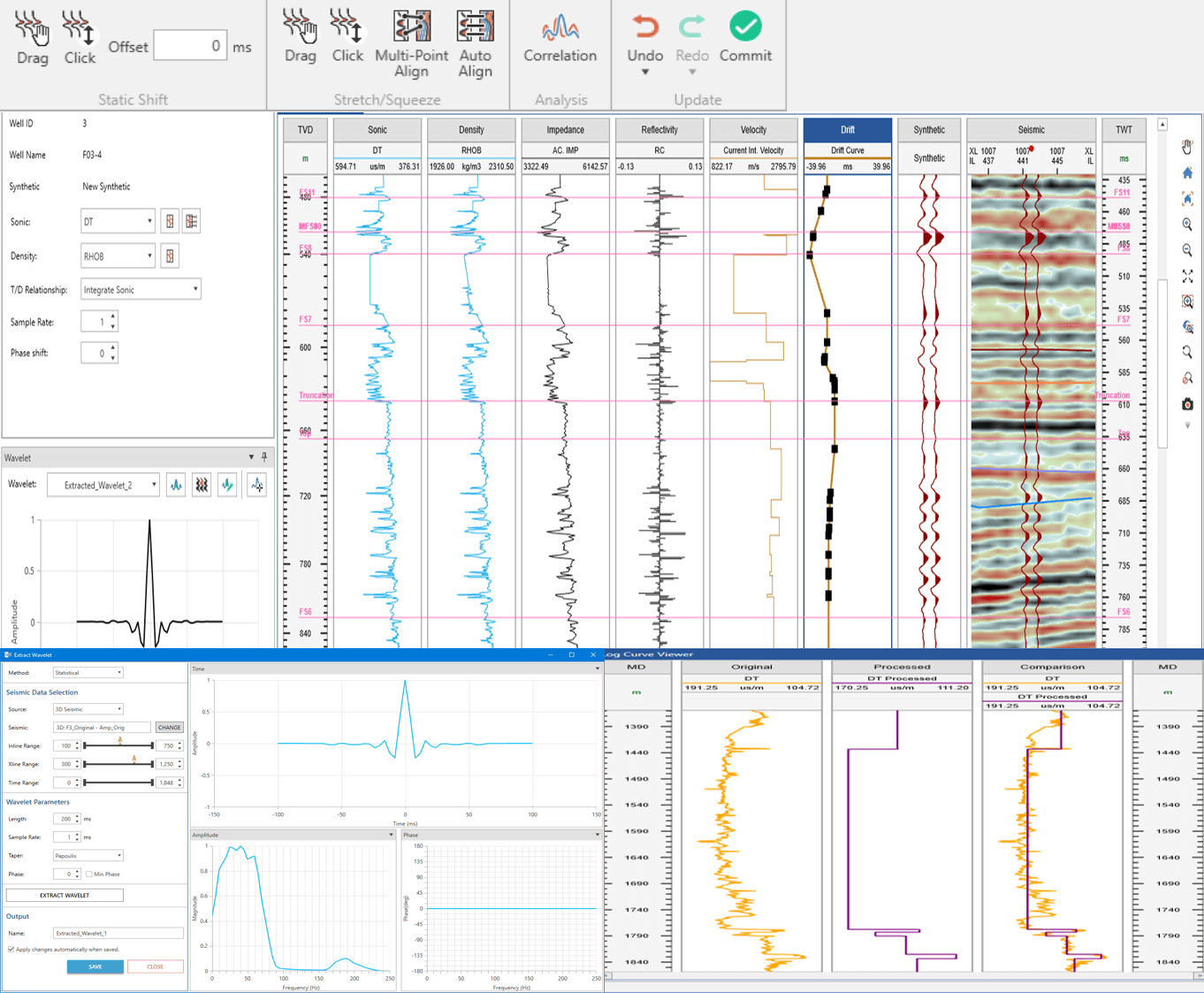
| 1. End-to-End synthetic creation and editing |
- Updated interface for creating and editing synthetic traces
- Create synthetic for deviated wells
- Extract wavelets from seismic
- Calibrate, process and estimate log curves
|
| |
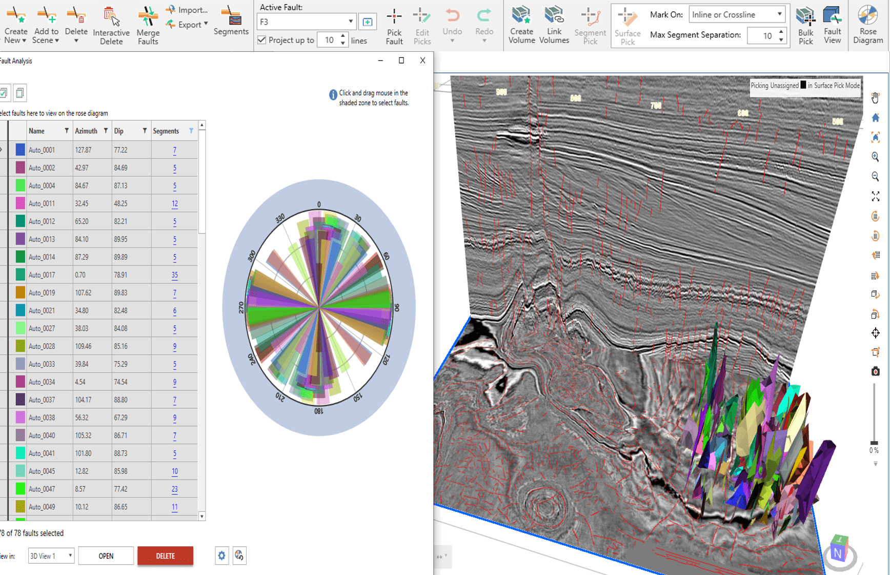
| 2. Automatic Fault Interpretation |
- Specialized fault attribute volumes to detect faults
- Create fault segments and surfaces automatically or bulk pick fault surfaces into interpretation
- Interactive rose diagram to quickly analyze and QC faults
- Faster manual editing by projecting faults on sections, merging, deleting and enhanced segment editing tools.
|
|
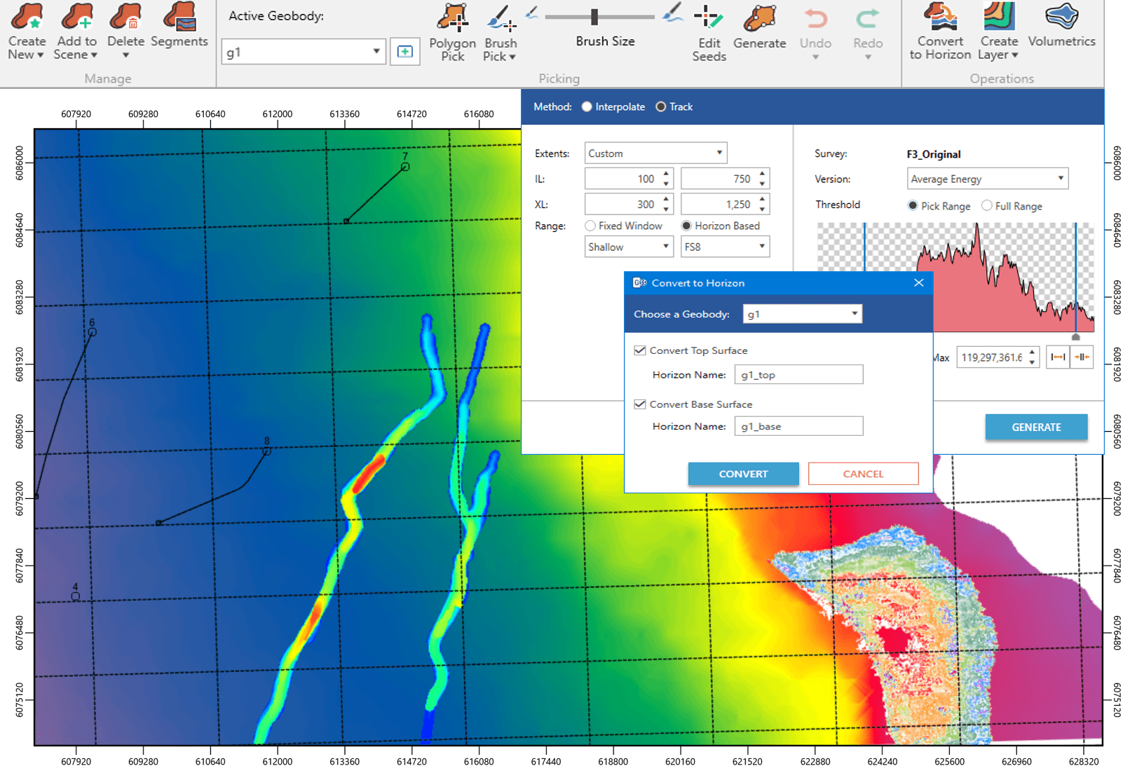
| 3. Enhanced Geobody Interpretation |
- Map and create layers for geobody surfaces and thickness.
- Convert geobodies to horizons
- Compute attributes on geobodies
- View depth converted geobodies in Depth View
|
| |
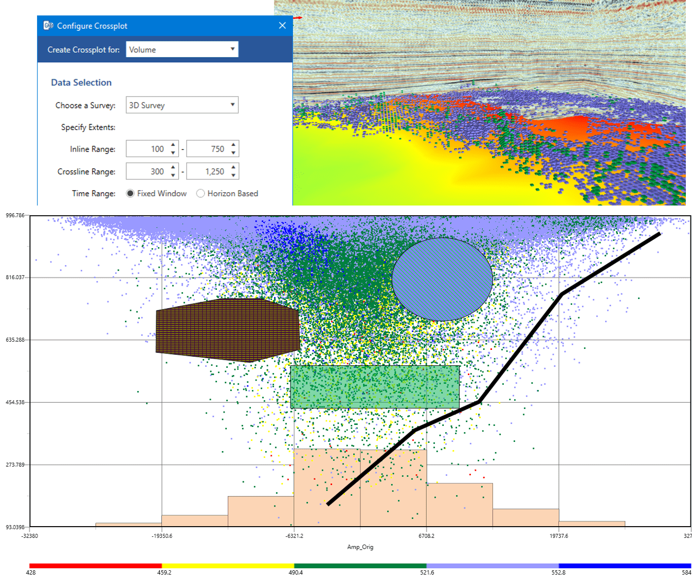
| 4. Crossplots for seismic volumes, well data and attribute surfaces |
|
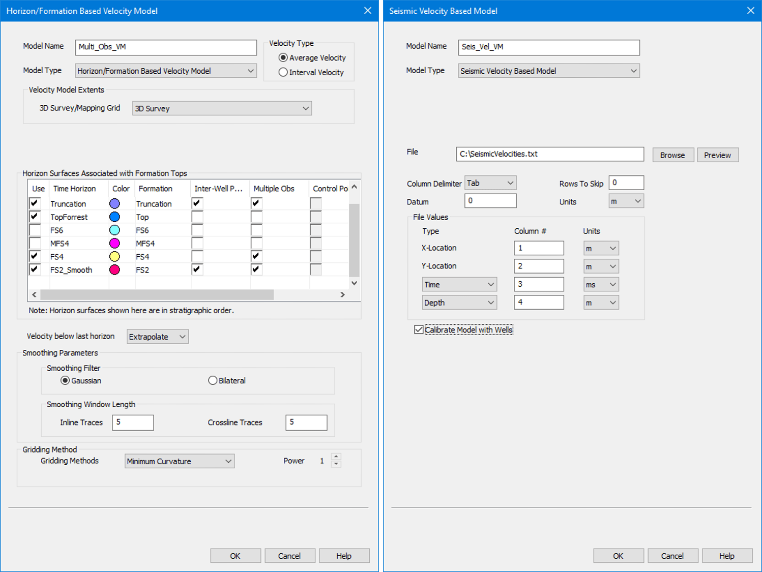
| 5. Depth conversion improvements |
- Use seismic velocity data to create velocity models
- Incorporate multiple observations in velocity models
- Create triangulated velocity models using T/D tables of selected wells
- Algorithmic improvements to create more accurate models
|
| |
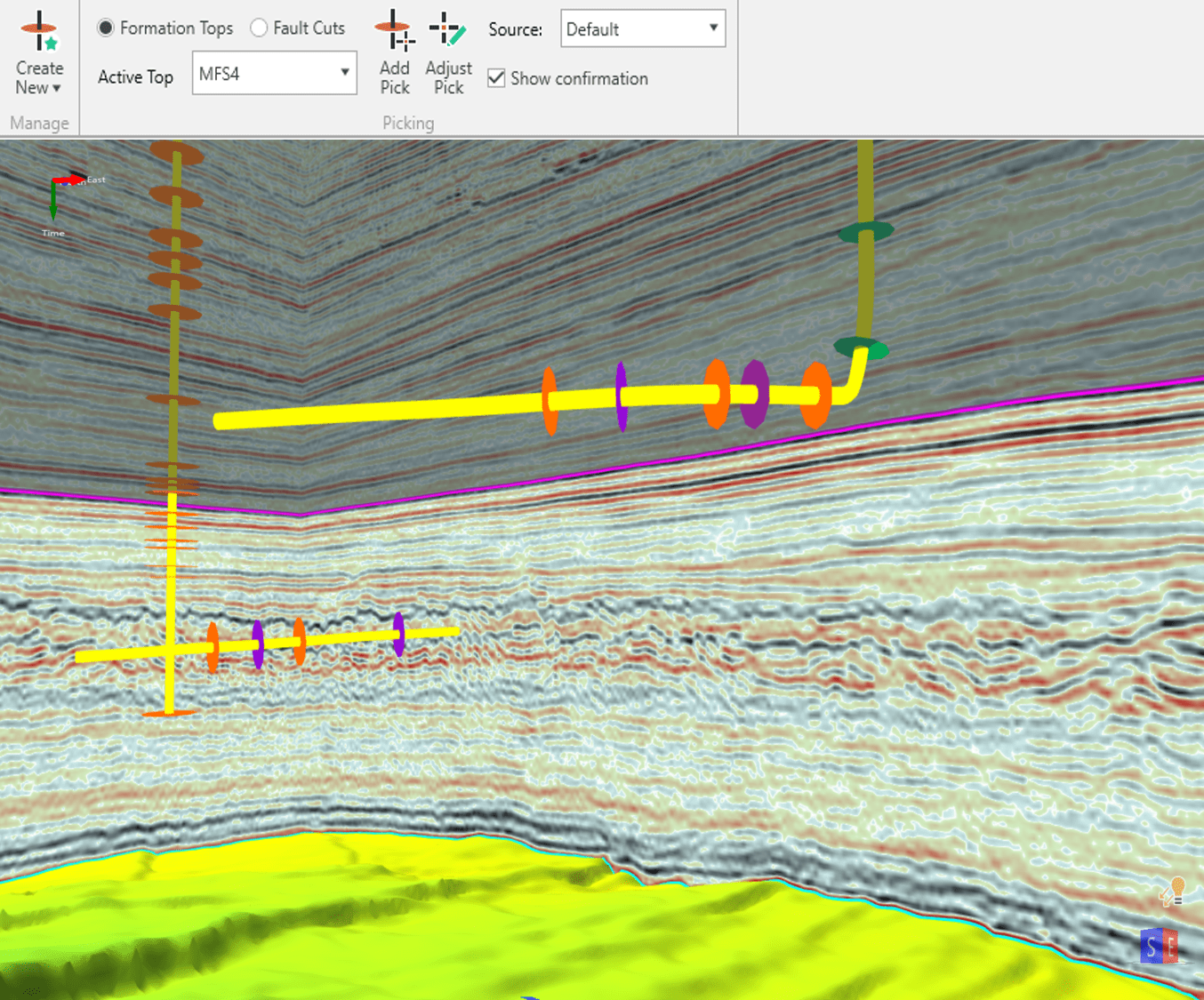
| 6. Well Top Picking & Editing |
|
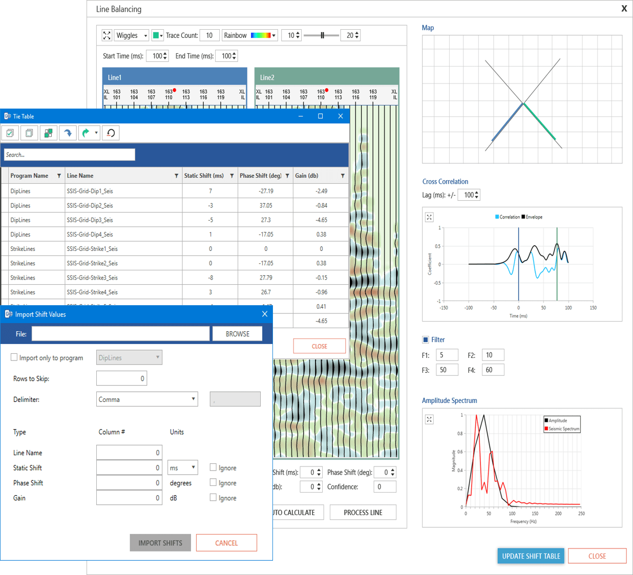
| 7. Updated 2D line balancing |
- 2D shifts table to add, edit and search shifts for all 2D lines
- Import and export shift values to ASCII files
- Updated interface and workflow for interactive line balancing
|
| |
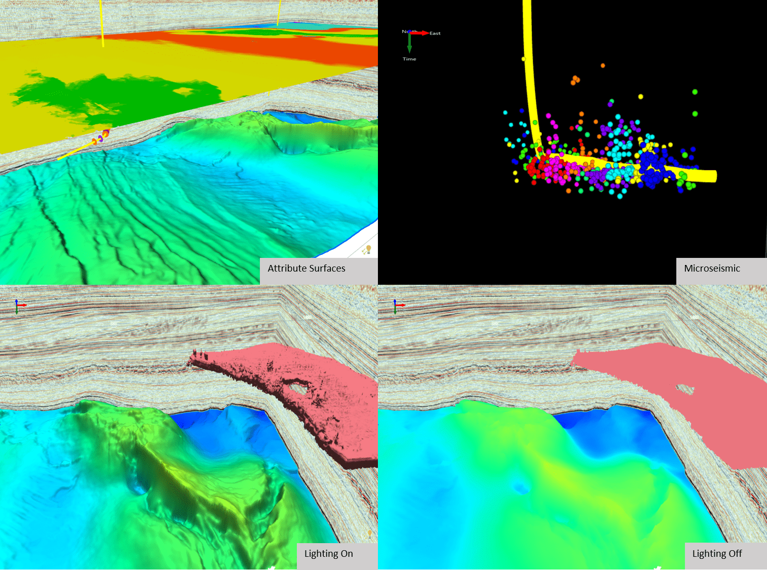
| 8. Lighting capability, microseismic data, crossplot points, attribute surfaces and more in 3D |
|
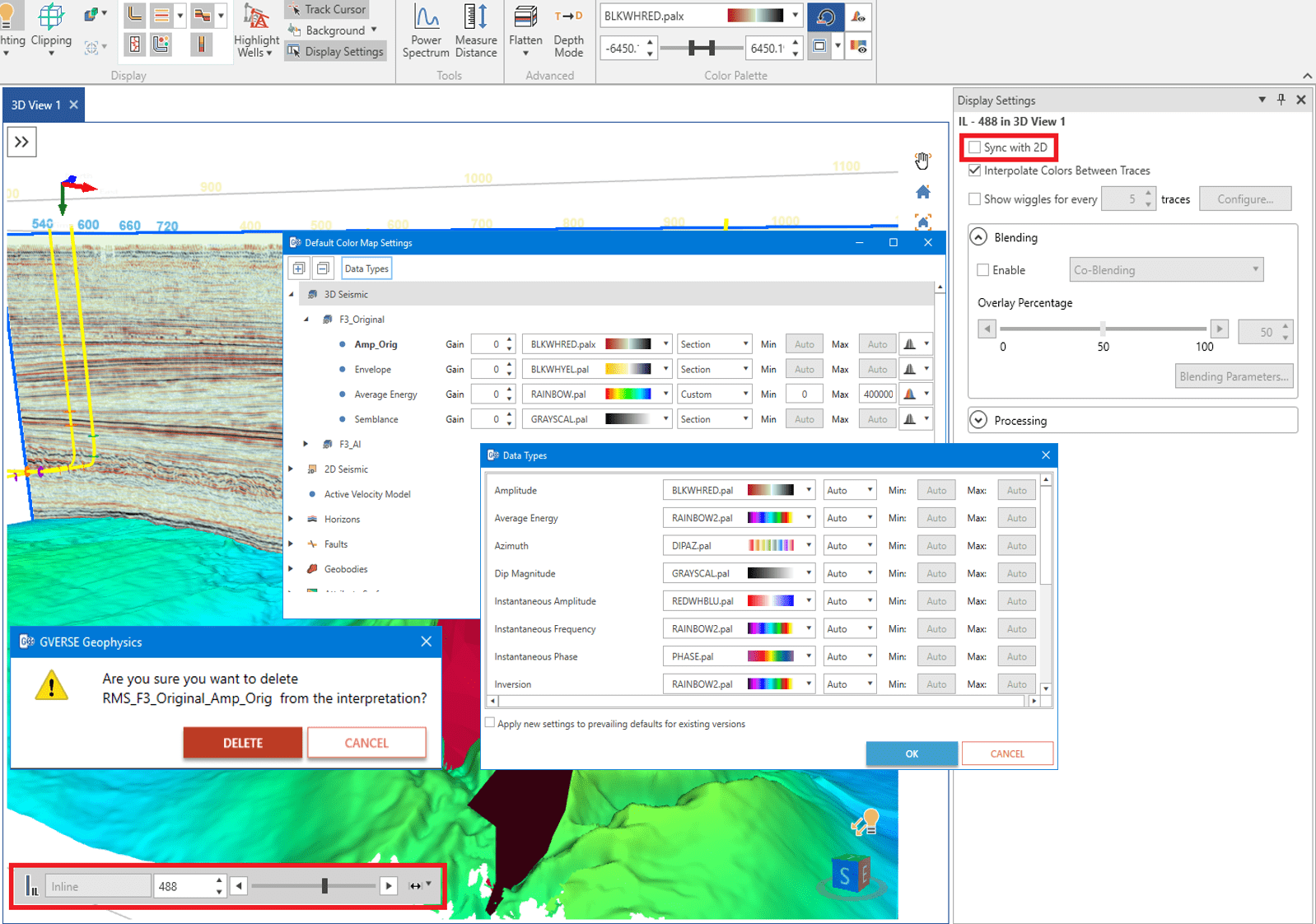
| 9. Usability enhancements for improved productivity |
| |
| 1. Performance improvements in user requested workflows. These include; |
- Reloading Surfaces and faults after adding, modifying or deleting interwell points
- Refreshing All Views
|
| |
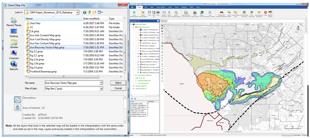
| 2. Ability to open GeoAtlas Maps in GVERSE Geomodeling. |
| |
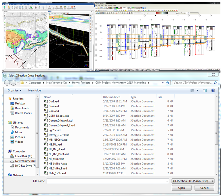
| 3. Opening XSection cross sections in GVERSE Geomodeling. |
|
| 4. Launching XSection cross sections in GVERSE Geomodeling from XSection layers. |
| |
|
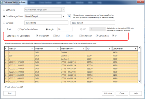
5. Improvements in Well Statistics module by introducing Completions, Perforations, IP, Casing and DSTs in Well Zone calculations.
|
| |
| 6. Ability to export smartSTRAT tie points. |
| |
| 7. Ability to show well intersections for active surface in map view. |
|
|
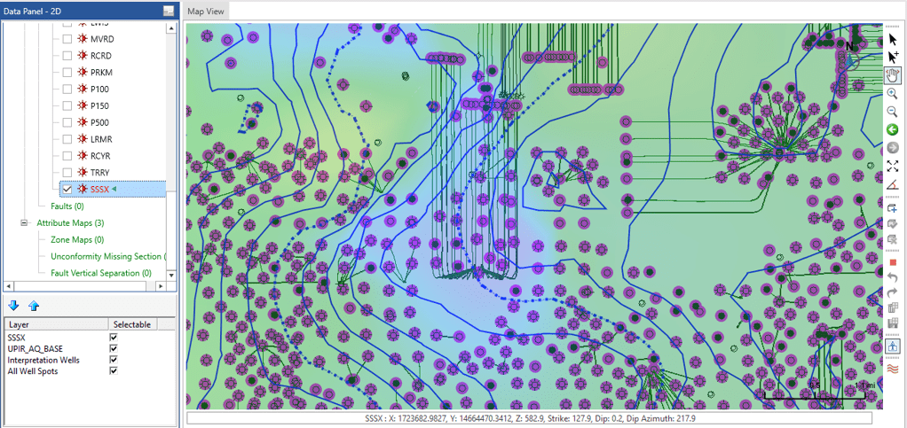
8. Spatial Polygonal Selection for selecting wells for different operations like creating cross section or calculating well statistics etc.
|
| |
| 9. Ability to create spatial cross sections in defined directions. |
| |
| 10. Ability to add/remove model zones. |
| |
| 11. Showing distance between wells in cross section view. |
|
1. New Well Filter For Wells with Curves that extent to selected Zone depths or Formation Tops
|
| |
| 2. Alphanumeric Data handling in LAS Import |
| |
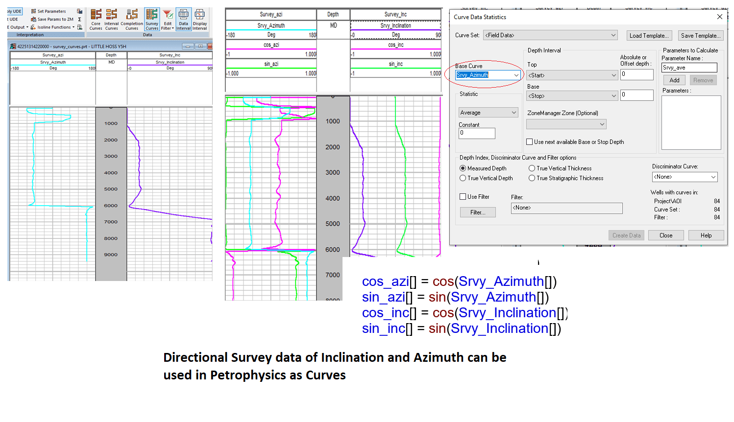
| 3. Use directional Survey (Azimuth and Inclination) data as Curves in Petrophysics analysis. |
|
|
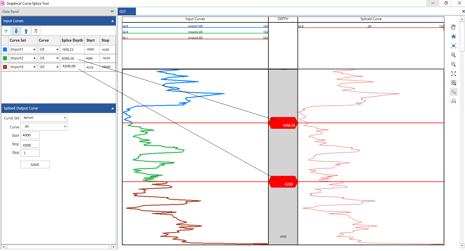
4. Graphical Curve Splicing
|
| |
| 5. UDE Editor fixes and improvement |
| |
| 6. Find Feature in Image list for displaying in Image Track of Log Template |
| |
| 7. Sorted lists of attributes in Assign Field Data Curvesets and Delete computed Curve sets |
| |
| 8. Customer Fixes |
- Server Busy error while creating IsoMap Layer from Curve Data Statistics
- Depth Registration Crash on Editing Depth
- Depth Registration Crash on corrupted user, glp files
|
| |
| 1. Ability to export well survey points in Geographic coordinates or custom projected coordinates. |
| |
| 2. Improvements in SAGD workflow by introducing following enhancements. |
- Ability to create pods by moving slots on map view.
- Ability to select and modify properties for Producers and Injectors individually on map view.
|
| |
| |
|
| |
| |
Disclaimer:
This web page is a preview and is provided for information only. The information contained herein is subject to change and cannot be guaranteed to be error-free. We therefore do not accept any liability for any errors or omissions in the contents of this web page or for the consequences of any actions taken on the basis of the information provided, unless that information is subsequently confirmed to be accurate in writing. |
| |